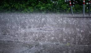

Hyderabad: Sudden spikes in rainfall across central and northern Telangana on Saturday disrupted daily life in several pockets, as the India Meteorological Department (IMD) forecast continued rain and thunderstorms across the state for the next four days. Hyderabad is expected to face high-impact rainfall on Monday, with all zones under watch.
The IMD attributed the ongoing activity to a combination of monsoon systems. “The monsoon trough is active over central India, and Telangana is experiencing embedded circulations within it,” said Dr K. Nagaratna, head of IMD Hyderabad. She explained that although a cyclonic circulation over south coastal Andhra Pradesh had weakened, an east-west shear zone persisted along the monsoon axis, keeping the broader flow vigorous. “These localised systems are causing brief but intense rainfall spells,” she said, warning that some zones may see rainfall rates crossing 2–3 cm per hour.
On Saturday, Jangaon recorded the highest daily rainfall in the state with 107.5 mm at Wadlakonda, despite having seen only light rain earlier this week. Kapra and ESS Malkaram in Medchal-Malkajgiri, along with Udithyal in Mahabubnagar, also crossed 75 mm. Karimnagar saw hourly rainfall touch 10 mm between 6 and 7 pm. The Telangana Development Planning Society pegged the state’s average cumulative rainfall at 5.1 mm, with wide district variations — Medchal-Malkajgiri at 25.9 mm and multiple southern districts below 1 mm.
As of 5 pm, cloud buildup was visible over central Telangana and Doppler radar data from Hyderabad and Warangal pointed to potential thunderstorm activity late Saturday night. Lightning alerts were issued for parts of Siddipet, Jangaon and Karimnagar. The IMD classified the overall intensity as “light,” though some mandals fell in the “moderate to heavy” range.
Reservoir levels in the Hyderabad region also rose marginally. At 6 pm, Osmansagar stood at 1782.75 feet (2.466 TMC) with inflows of 1,200 cusecs, while Himayatsagar reached 1759.10 feet (2.156 TMC) with inflows of 1,300 cusecs. No gates had been opened as of evening.
Flight operations at RGIA were delayed between 6.15 and 7.30 pm due to crosswinds and shifting visibility, with four departures temporarily held on the tarmac. In Hyderabad, municipal officials advised residents in low-lying colonies to avoid venturing out during night hours. GHMC deployed water pumps in over 20 localities and activated emergency response teams across the city.
Looking ahead, the IMD has issued yellow alerts for heavy rain across several districts, including Jayashankar Bhupalpally, Mulugu, Khammam and Mahabubabad on Sunday. From Monday, the system is expected to intensify in Warangal, Hanamkonda, Ranga Reddy, Medak, Kamareddy and parts of the GHMC region, including Hyderabad. All six city zones — Khairatabad, LB Nagar, Charminar, Secunderabad, Kukatpally and Serilingampally — have been classified under the “high-impact” category for July 21, with warnings of traffic congestion, waterlogging, and stormwater overflow.
Monday is expected to be the peak day of disruption, while Sunday, Tuesday and Wednesday may see moderate to light rain with occasional gusty winds and cloud cover. Thunderstorms with wind speeds reaching 30-40 kmph are also expected. Residents, especially in flood-prone areas, have been asked to remain alert and avoid unnecessary travel during high-intensity windows.